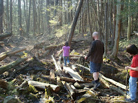
The big one.
Every year I try to do a "big hike". One that requires me to actually train. I'm in fair shape for a 43 year old computer jockey, but the rock pile requires a bit more.
My buddy Lou and I hiked Moosilauke last summer and he wanted to try the hardest trail on the toughest mountain in New England. That would be Huntington Ravine on Mount Washington. I had been up Huntington before so I knew what to expect. Lou hadn't and I did my best to warn him.
A little history: Back in 2003 my brother-in-law Mikey and I hiked Monadnock. It was tough but we wanted to try something bigger. Using the same thought process as Lou, I suppose, we tried Washington via Tuckerman. I wasn't prepared. I wrote about it and maybe I'll post what I wrote for history's sake.
We skipped 2004 then tried Huntington in 2005 with Mikey and another brother-in-law. We learned that he had a crippling fear of heights and we had to come back down. In 2006 Mikey and I did Katahdin. Twelve hours on the trail, 7 am to 7 pm. It was that hike that convinced me to always carry a flashlight. In 2007 Mikey, a co-worker Chuck, and I climbed Washington via Huntington. We took the bus down. 2008 was Franconia Ridge, Little Haystack to Lincoln to Lafayette. Mikey and my oldest son went on that one. That brings us to 2009 and Moosilauke, which you can read about if you are so inclined. The sneakers that nearly cost me my life that day were since trashed and I had considered getting serious hikers for Washington. I didn't end up doing that.
I did some treadmill, but as I've pointed out before, an hour on a treadmill ain't five minutes on the hill. So I also did weights. Squats, specifically. Lots of them. I lost maybe ten pounds, which was less than I wanted to. I was as prepared as I was going to get.
It was just Lou and I this trip. Mikey couldn't get off from work. We camped at Dolly Copp and made the trail around 9:30. Much later than I wanted to. I woke with a charlie horse. I get them maybe twice a year, and today was that day. Another injury also had me concerned. Back in May I was at a child's birthday party at a roller skating place. The last time I put on skates was 25 years earlier, maybe to the day, who knows. I was my post-prom at the very same rink. This day, on my last lap, I fell backwards and sprained my right wrist. At post time it still hurts. How would it react to climbing at the headwall?
Pinkham Notch was busy. Very busy. First of all, it was the high season for through hikers, but added to that was the fact that there were two benefits going on. Alzheimer's and something else, I forgot. A lot of non-hikers were on the trail and I was glad to occasionally chat with them.
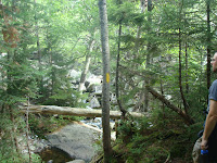
As expected, we turned off onto Huntington just below the tree line and the crowds disappeared. I tripped and landed on a moss covered log. Lou didn't think anything of it, and neither would I, normally. But I had put pressure on my wrist, and it hurt. A lot. We saw only a couple people before we reached the treeline. Once the trees were gone people were easier to spot. The climb by the fan was tough and I was looking forward to reaching the headwall. Chatting with others, a woman looked at me surprised and said "this isn't the head wall?" "Um, no" I said.
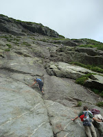
The headwall is one hell of a sight. Last time it scared the bejesus out of me and was where we had to turn around. I felt good but wondered about my wrist. And my sneakers. Well, at least my charlie horse wasn't bothering me much. The woman I spoke with and her friend were ahead of us. They spent some time looking and feeling and thinking and I was happy for the brief breather. In the end they chose to turn around.
I put my hands on the rock face. I felt strangely confidant. Maybe because I had been there before or maybe because my legs, thanks to the squats, were in much better shape. At any rate, we went up. And it was fun.
Above the headwall is a moonscape. Very little vegetation grows this high. We followed the cairns along a hard to see rock path. Relentless, just as I expected. Lou hadn't anticipated how relentless and grew tired of the monotony. We got close to the auto road and he wanted to follow it. I didn't. I hate road walking and was up for the challenge, but we followed it. He was exhausted and the road allowed us to double our pace. Soon the summit building came into view.
Point to point, it was five and a half hours to the top. We stayed there for an hour and a half resting and gorging ourselves. The food item we both declared the most wonderful, most spectacular to partake in: Coca-Cola. I can't explain it. It was glorious.
I didn't want to bus down again so I let Lou get as much rest as we could afford and we took the easiest path down. Of course there is no easy path down, but we got back to Pinkham Notch well before sunset. Back at camp we built a fire and made food, even though we weren't very hungry. In the morning we stopped at Pinkham Notch and had the coldest showers of our lives.
Lou did great. Much better than I in my first two attempts. It seems my wrist wasn't a problem. I can pull weight with it without problem, I just can't flex it backwards. And I really owe Mike at the YMCA a debt of gratitude for putting me on the leg squats routine. It made all the difference.
I want to go again.
Take a look at this guy's video. We met him on the hill that day.
Tuesday, August 31, 2010
Monday, August 2, 2010
John B. Hudson Trail, Arcadia
July 24, 2010
Only a couple photos this time. I didn't ask for permission again. Seven cub scouts and two boy scouts joined five parents for a walk on the John B. Hudson trail in Arcadia. It's only three miles and the weather was fine. A little hot, but cooler in the damp forest.
The trail is well marked and an easy stroll for little ones and urbanite moms alike. It passes by a historical graveyard (town of Exeter 101) where the boys took a brief break. The trail loops near the end and passes by Breakheart Pond.
We dallied by the pond. The boys appeared to be having a great time. The path back towards the graveyard was muddy much to the delight of the boys. A couple of the moms weren't quite as pleased. It dried up soon enough and we were back on the same trail that took us out. If you read my blog, you know how important I feel it is to get kids into the outdoors. A simple thing like a 45 minute drive, a 1 1/2 hour walk, and a light snack can do wonders. And we got a few scout requirements out of the way.
Friday, July 23, 2010
Pachaug State Forest, Voluntown, Connecticut
July 9, 2010
With two hikes in my immediate future, one my Big one, I had better catch up with my walks.
I volunteer with my son's boy scout troop at summer camp each year. My now ex-coworker Lou and I got together on Friday to do a hike near both of us. He works over the line in Connecticut, and we had talked about doing some backpacking, so we chose Pachaug State Forest, which has a couple lean-to's we might wish to stay at in the future. This hike provided us a look-see. Yet again, no photos.
We met at the corner of routes 138 and 201, parked, and entered the woods. Normally I would follow along using my map, but my awesome Great Swamp Press map appears to be missing. Maybe it ended up with my scout gear, maybe Lou ended up with it. I'd hate to lose it. They are rather pricey.
We followed Pachaug Trail (I think half the trails in the forest are called Pachaug) until we got to the lean-to. Needed a sweeping, but in rather good shape. The area around it looked well used by hippy hiker and destructive teen alike. Next we doubled-back to take a look at mount Misery. At an astounding 441 feet above sea level, Misery provided for a significant climb. We got to the top and met up with a young family enjoying the view.
The bugs were fierce. I don't normally wear bug spray, but this day was the exception. We would wave our hands above our heads and knock away several deer flies that would return about a minute later. I've never been bitten by a deer fly but I understand they can be almost as painful as horse flies. Camp Yawgoog has lots of horse flies. My floppy brim hat kept them and the sun at bay.
We continued North because Lou wanted to see a location he had been to in his youth. The name escapes me. We got about half way there when Lou's curfew grew short. We doubled back to the start. I tried to entice him in getting a beer together, but his wife and child needed him home. We parted ways and I found a nice place that served cold beer and a better than average pub burger, by young ladies in tight t-shirts. I got back to camp to find out I missed meatloaf night.
Saturday, July 17, 2010
Ben Utter Trail, Arcadia
Some work day back in June.
My wife and boys arrived at my work with the idea of doing a hike. For once, it wasn't my idea. Her favorite was one of her first. The Ben Utter trail in Arcadia. I navigated a path from Narragansett to route 165. I dropped my car off in the church parking lot and transferred to her van. We took unpaved Frosty Hallow trail to Plain Road.
I learned when I did the Shelter trail a few weeks earlier that Plain road was barred a fair ways from our trail head. I also learned that Plain road was in unusually bad shape. My wife is not in the habit of slowing down on bad roads. We stopped where Plain road did and was preparing to walk the rest of the way, when a lady in an SUV drove around the barrier. We decided to follow. Plain road got worse and had to slow a little. We found the trail head parked next to the SUV.
The camera stayed home so no pictures yet again. We followed the trail as usual and I took the opportunity to do some scout requirements for my ten year old. We hiked to stepping stone falls, had a snack, then went by the abandoned shelter on our way back. It felt good to be in the woods.
W made it back in reasonable time and drove home. The transmission work only cost me $100, so I count myself as lucky.
Saturday, June 26, 2010
North South Trail, Kenyon Hill to Roaring Brook Pond
Saturday, May 22nd
Maybe my interest in blogging is waning. All blogs have a life expectancy. Maybe I am seeing the end. My interest in hiking, however, has not. With my son's Boy Scout troop, we hiked 8.7 miles.
First, there are no pictures. I didn't take many, but none are included because when I asked if anybody objected to having photos posted on the internet, a couple scouts said yes. I don't know if they were serious, but then again, I didn't ask. We picked up where we left off, on Kenyon Hill Road.
Five scouts, the Scoutmaster, and I entered the forest and walked until it turned into a well groomed community. We followed streets until we reached route 138. We turned right towards the Richmond Elementary School. There was a farmers market going on, but it was across the street. The boys decided not to investigate. We turned left onto Nooseneck Hill Road, where we saw and smelled cows.
We turned left onto Buttonwoods Road. A little ways up we turned North into the woods again. Soon we stopped for lunch. The trail connects with the "New London Turnpike", which an ATV would be hard pressed to traverse in comfort. Along the way we crossed a makeshift living room, complete with couch, rug, and lamp. We joked that this is were we should have lunched, but clearly few would want to touch the junk.
A little bit more road work, then we were back into the woods. We crossed under route 95. We followed the trail until it turned onto Tuft Hill Trail, a dirt road off of which I parked. The boys and Scoutmaster chose to walk the boardwalk around Roaring Brook Pond to the paved road. I brought the van around.
There was a lot of street walking, but it was fine. Much of it was very pretty. The weather cooperated and we managed to get through the tenderfoot material for our youngest scout.
Thursday, May 27, 2010
Shelter Trail, Arcadia
Saturday, May 15
A little late getting around to posting, huh?
I was supposed to assist with DEM and AMC volunteers for a maintenance project on the Ben Utter trail in Arcadia. I got a late start. A very late start. I figured I would just find them on the trail. I was wrong.
The forest path that is called Austin Farm Road is now blocked before you reach the Ben Utter trail head. Had I remembered my Arcadia map from Great Swamp Press, I might have figured that out. I didn't have any cell phone numbers, so after an hour of pointless driving around, I stopped at the Shelter trail and started walking.
After a short walk, maybe a half mile, I ended at a river (Flat River, I learned). I saw a side path a short walk back, so I took it. Come to find out, the walk to the river is the side trail and I was back on Shelter trail proper. I followed until it reached some, well, shelters. Mostly dissolved at this point. I continued on.
I passed Penny Cut off but stayed on Shelter. I came to a spot that was quite beautiful. I took some pictures. Continuing on, I apparently merged onto Breakheart trail. I heard people ahead and wondered if it was the camp. Camp E-Hun-Tee is for kids in bad situations, I understand. I know very little about it, except that it's off limits. Soon, I came upon some boys near some makeshift shelters. From a distance I asked if this was the camp. One said it was. I said I should turn around, then. They agreed. I didn't think I was close to the camp at all and wondered why there were no signs warning me. Soon I passed a tree with a sign about twenty feet up it. Knowing where I was and knowing the situation, I figured out that it was a warning that the camp was off limits. Otherwise, I would have had no idea. They need a new sign, and they need to hang it lower.
I followed the trail back, stopping off at a concrete foundation to take care of some feet problems. My old hikers were tearing my feet up fairly bad. I popped on a couple bandages and continued on. I got back to the car and headed home.
The volunteer group worked a different section of the trail, I learned. They ask me to volunteer about three times a year, and I've only managed to participate once.
Thursday, April 1, 2010
Walkabout Trail
Sunday, March 21
It seems that I have even less time to blog about my hikes, than I do to take them. As I mentioned in my last post, I was hosting a visitor from New Mexico who wanted to hike Rhode Island's high point. Afterwards we went on a real hike.
Walkabout trail was named by Australian sailors who walked the trail while their ship was in dry dock in Newport. That's what I would have done. George Washington Management Area includes the George Washington Camping Area. I had never visited this property before.
There had been a bit of rain before this hike. Nothing like what we'd soon get, but enough to be concerned. I didn't think we'd have too much trouble. I wasn't exactly correct.
The trail included a bit of blowdown, some muddy areas, and a nice view of the pond. Healthy hemlocks were in evidence. From the Weber book I knew there was beaver in the area so I kept an eye out. We found a lot of tree damage and what was probably a small den. We didn't see or hear any animals.
I thought when the trail left the ponds it would dry out. Not measurably, as it turns out. We came to a point where the train appeared to end in a swamp. After closer inspection, I saw that the trail ran clockwise around it.
Wetness continued, but the little ones perservered like chamions. In fact it may have been me that was most troubled by the water, and I was in hikers.
We crossed more puddles and small streams.
Finally, the end was in view.
Not a moment too soon, as the sun was going down. The campground wasn't open yet. I'm sure it's a beautiful place to camp, but I appreciated the quite during the last few weeks of the off season.
Saturday, March 27, 2010
Jerimoth Hill
Sunday, March 21
The 17 year old son of a cousin of my mother-in-law was visiting from New Mexico. One of the things he wanted to do during his first visit to Rhode Island was to climb it's highest peak, 812 feet above sea level. I had done the arduous climb up Mount Jerimoth before, so I prepared him for the grueling journey. The drive, that is. We went with my youngest son, my brother-in-law, and his daughter.
Jerimoth Hill has an interesting history. Brown University owns the peak, but the most direct path from route 101 had no public access. The man who owned the land did not allow access, even to the point of threatening violence on trespassers. Eventually, he relented and allowed hikers on certain holidays. He has since passed, and new owners allow access all year from 8:00 am to 4:00 pm.
Brown has an observatory in a clearing near the peak, so clearly there is another path. There are stories of people bushwhacking through bogs to visit the peak. It would seem to me that a public land trail could have been constructed a long time ago to avoid this controversy. The trail as it stands is a mere 200 yards from the highway. I'm very thankful that the land owners have made this path available, but much of the story seems pointless. Having been on this path before, I knew what to expect. I cautioned my visitor not to be disappointed.
The further West you go and away from the ocean, the higher the land is in Rhode Island. Here, on the faintest of hills, is what passes for a high point. On the walk from Route 101 you cannot perceive an incline. If you continue the eight tenths of a mile west into Connecticut, I'm sure you'll have trouble finding land lower than 812.
This hike in the past, we walked back to the car. There are a couple nearby walks in my Walks and Rambles book. Durfee Hill is closest, but I had been there and was fairly unimpressed. Besides, the recent rains made that one even less desirable. I took the group to the Walkabout Trail in the George Washington Management Area, but more about that later.
Sunday, January 17, 2010
Fisherville Brook, Exeter
Sunday, January 10
Fisherville Brook was clearly my most hiked property in 2009. It's beautiful, convenient, and accessible. When I first walked it in May I knew it would make a great Cub Scout hike. And it did.
Every year we do a January hike, and every January there is a boy who thinks a spring jacket and tennis sneakers are appropriate winter hiking attire. Last year it was a fifteen year old sibling. I have a warning in the flier, but this year I decided to emphasize the point. The high temperature was expected to be 27 and I cautioned the parents to make sure they were prepared. They responded in droves. By not attending.
Five boys, my three and two others, hiked the Blue and Orange loop on the south side of the property. The weather was crisp, clear, and cold, but luckily there was little wind. The snow was not too fresh so animal prints were not as clear as they were last January, but the going wasn't as tough either. There was some complaining, but no real problems. The scouts that attended were prepared and everyone enjoyed themselves.
I made a ton of hot chocolate because I didn't know how many to expect. Suffice to say, we had a ton left over. Shortly after returning to our car, some people with small children exited the trail. One boy came up to us and asked for hot chocolate. He told him to ask his parents, who said no. I approached them and said how we had way more than we could use and offered hot chocolate to everyone. Happily they took us up on it.
These winter hikes teach some important lessons. First, it give a child practice in preparing for the weather. A Boy Scout is told he must "Be Prepared", but before that can happen, he needs practice. Also, all of us are tempted to spend the winter indoors, sheltered from the world. There is no need for this. Winter blues effects many of us, myself included. An excursion like this allows us to engage winter, and not fear it. And getting children into the outdoors is so very important. It's very disheartening that so many chose to stay indoors.
Subscribe to:
Posts (Atom)