Date Unknown, 2012
It's time I caught up with my hiking habit. This is pathetic.
Sometime in 2012, the troop hiked Hazard Road to Nicholas Road on the North South trail. I remember little of it. I remember one boy managed to kick himself near the beginning and complained loudly the whole way. I remember another boy decided he couldn't finish the hike and had to stop with an adult. A couple more thought that was a nice idea but I said NO!
One boy on the hike I was rather concerned about. He was grossly overweight and suffered from being tired much of the time. This I attributed to a terrible diet. He seemed quite a bit slimmer that day and didn't have too much trouble on the walk. I remember that his mom picked him up at Place Farm and that was the last time I saw him. I'd like to know that he turned his life around.
In a perfect world I would write my notes down the same weekend as the hike. Hasn't happened yet. This is the perfect example. When referencing my trail book I came to the conclusion I entirely forgot about a hike. As such, I don't have any clue when this particular one happened, but I thought it was late summer. Couldn't have been, but that's what I remember.
Let's see how the next year goes. If I still don't keep up, well, then the handwriting is on the wall. Unlike many hiking blogs I have followed over the years, I will say Goodbye when I conclude the experiment.
Promise.
Monday, December 23, 2013

Sunday, September 8, 2013
A Word about Gear
This recent trip was my first backpacking journey and while I've spent a lot of time thinking about and researching gear, I knew there was no substitution to the education of trial and error. Here is what I used and how it performed. No links. I don't do advertising.
The Pack
I purchased a cheap Outdoor Products internal frame pack at Walmart. The model is Arrowhead 8.0 and I think the capacity is 65L. The model was being discontinued and it was deep discounted to something like $25. Nobody can argue with that price. It may not of had quite the capacity I needed and could use some easy to access pockets, but after inventory was exhausted the next cheapest pack was around $50. I found the option good enough and once I get a little smarter about packing, the size should be workable for a weekend trip.
Food and Cooking
Coleman makes a cheap, light, propane backpack stove. Walmart sells it for about $25. Coleman Max 3001 series. I brought along two 4-ounce propane containers. One was more than enough. It operated reliably. A JetBoil unit might boil a gallon of water in 40 seconds, but cost six times the price.
I purchased a Mountain House beef stew a while ago but never ended up eating it. It sat around. For about four years. So, I brought it along. The package was still air tight, so it was still good. The salt content meant it wouldn't ever go bad. It was terrible. A little beef would have made it better. Gonna try that Packit Gourmet stuff next time.
Breakfast was coffee and oatmeal. I do the same thing when car camping: one plain and one flavored packet of instant oatmeal into a snack zip top bag. Throw it into a bowl (generic stainless sierra cup) with some hot water, and voila: breakfast! This time I added extra raisins. It was perfect.
Coffee is more of a challenge. I measured enough grounds for 32 ounces of coffee (I was supplying for my brother-in-law) and put it into a snack baggie. I measured sugar and powdered creamer for 16 ounces into another baggie. I got a collapsible backpacking coffee maker a while back and never used it. The brand is GSI Outdoors. A quick test run in the kitchen and I was set to go. It worked reliably, was light, small, and a snap to clean. And it made good coffee.
One misstep I did was bringing a full sized boiling pot when I only needed 32 ounces for coffee, plus maybe six for oatmeal. The sucker I brought would have done 64 ounces without breathing hard. I did fill it with other gear when hiking, but still, total overkill. I'll find a better solution next time.
I decided at the last minute to get a water filter. I couldn't determine if there was potable water on the trail, so I ended up getting a Sawyer squeeze water filtration system. It was a little cheaper than the backpacking pump, smaller, and lighter. I didn't end up using it until Saturday and was lucky enough to have an experienced hiker show me how it works. It comes with three bags (16, 32, and 64 ounces) and a syringe for cleaning. All I needed was one bag plus the unit itself, but I didn't know and brought everything. It was easy to use if not all that speedy, and the water tasted great. Tap at the mountain top restaurant was terrible. Not sure how often I'll be using it outside of backpacking, but I really did need it. Raw stream water might have been safe, but also maybe not.
Sleeping
There are two things I splurged on. First is the sleeping pad. Old bones can't sleep on the hard, hard ground. I got an REI Stratus and if I were to complain about it at all, it was that it was a little narrow (20"). The rated weight is one pound four ounces and it packs rather small. It takes 30 breaths to fill. For car camping I have the option of bringing the large and heavy inflatable mattress and the large double-stroke pump, but I won't anymore. Now I'll bring something half the size of the pump, spend less time on set up and take down, and be more comfortable. I can't express how well this sucker performed.
Additionally, I brought the cheap fleece sleeping bag I use for summer camping. I was a little nervous because I didn't know how cold it might get in the mountains, but it was plenty warm. There are better options for sale, but I didn't need it. Not this time, anyhow.
Footwear
A hikers most important piece of gear is his boots. I routinely hike in cheap sneakers and this time I wanted to change that. I splurged on an expensive pair at REI. I used them around the office for a week then took them on an extended day hike with the Boy Scout troop. They are Oboz mid height hikers and I paid somewhere in the $160 range. I have high arches and need shoes to match. They are rather comfortable and provided decent (not amazing) traction, but the bottoms are rather hard. After significant walking, the bottoms of my feet hurt. I'll call them a success but I will investigate inserts.
My hiking socks disappeared prior to the trip. I had a minor epidemic that week. They don't get used except for hikes and stay in my sock drawer the rest of the year. They escaped. I hiked in white athletic socks. They functioned.
Stuff I didn't need
I mentioned in the previous post that I carried a two pound bag of trail mix that I never opened. Lesson learned. I also got a 96 ounce nalgene cantene (their spelling, not mine) that the REI salesman talked me into. Never opened. Luckily it doesn't weigh much. Maybe I would have needed it if there was a potable tap at the campsite. Lastly, I wore one of those cheap paracord bracelets. Just in case I needed a length of rope. Never did, but it wasn't a bad idea. I wore it on my left with my watch and it kept resetting the time. That was a problem.
There are the nuts and bolts of my gear experience. Maybe interesting me to alone, but worthwhile putting on "paper" anyhow. Thank you for ... listening?
The Pack
I purchased a cheap Outdoor Products internal frame pack at Walmart. The model is Arrowhead 8.0 and I think the capacity is 65L. The model was being discontinued and it was deep discounted to something like $25. Nobody can argue with that price. It may not of had quite the capacity I needed and could use some easy to access pockets, but after inventory was exhausted the next cheapest pack was around $50. I found the option good enough and once I get a little smarter about packing, the size should be workable for a weekend trip.
Food and Cooking
Coleman makes a cheap, light, propane backpack stove. Walmart sells it for about $25. Coleman Max 3001 series. I brought along two 4-ounce propane containers. One was more than enough. It operated reliably. A JetBoil unit might boil a gallon of water in 40 seconds, but cost six times the price.
I purchased a Mountain House beef stew a while ago but never ended up eating it. It sat around. For about four years. So, I brought it along. The package was still air tight, so it was still good. The salt content meant it wouldn't ever go bad. It was terrible. A little beef would have made it better. Gonna try that Packit Gourmet stuff next time.
Breakfast was coffee and oatmeal. I do the same thing when car camping: one plain and one flavored packet of instant oatmeal into a snack zip top bag. Throw it into a bowl (generic stainless sierra cup) with some hot water, and voila: breakfast! This time I added extra raisins. It was perfect.
Coffee is more of a challenge. I measured enough grounds for 32 ounces of coffee (I was supplying for my brother-in-law) and put it into a snack baggie. I measured sugar and powdered creamer for 16 ounces into another baggie. I got a collapsible backpacking coffee maker a while back and never used it. The brand is GSI Outdoors. A quick test run in the kitchen and I was set to go. It worked reliably, was light, small, and a snap to clean. And it made good coffee.
One misstep I did was bringing a full sized boiling pot when I only needed 32 ounces for coffee, plus maybe six for oatmeal. The sucker I brought would have done 64 ounces without breathing hard. I did fill it with other gear when hiking, but still, total overkill. I'll find a better solution next time.
I decided at the last minute to get a water filter. I couldn't determine if there was potable water on the trail, so I ended up getting a Sawyer squeeze water filtration system. It was a little cheaper than the backpacking pump, smaller, and lighter. I didn't end up using it until Saturday and was lucky enough to have an experienced hiker show me how it works. It comes with three bags (16, 32, and 64 ounces) and a syringe for cleaning. All I needed was one bag plus the unit itself, but I didn't know and brought everything. It was easy to use if not all that speedy, and the water tasted great. Tap at the mountain top restaurant was terrible. Not sure how often I'll be using it outside of backpacking, but I really did need it. Raw stream water might have been safe, but also maybe not.
Sleeping
There are two things I splurged on. First is the sleeping pad. Old bones can't sleep on the hard, hard ground. I got an REI Stratus and if I were to complain about it at all, it was that it was a little narrow (20"). The rated weight is one pound four ounces and it packs rather small. It takes 30 breaths to fill. For car camping I have the option of bringing the large and heavy inflatable mattress and the large double-stroke pump, but I won't anymore. Now I'll bring something half the size of the pump, spend less time on set up and take down, and be more comfortable. I can't express how well this sucker performed.
Additionally, I brought the cheap fleece sleeping bag I use for summer camping. I was a little nervous because I didn't know how cold it might get in the mountains, but it was plenty warm. There are better options for sale, but I didn't need it. Not this time, anyhow.
Footwear
A hikers most important piece of gear is his boots. I routinely hike in cheap sneakers and this time I wanted to change that. I splurged on an expensive pair at REI. I used them around the office for a week then took them on an extended day hike with the Boy Scout troop. They are Oboz mid height hikers and I paid somewhere in the $160 range. I have high arches and need shoes to match. They are rather comfortable and provided decent (not amazing) traction, but the bottoms are rather hard. After significant walking, the bottoms of my feet hurt. I'll call them a success but I will investigate inserts.
My hiking socks disappeared prior to the trip. I had a minor epidemic that week. They don't get used except for hikes and stay in my sock drawer the rest of the year. They escaped. I hiked in white athletic socks. They functioned.
Stuff I didn't need
I mentioned in the previous post that I carried a two pound bag of trail mix that I never opened. Lesson learned. I also got a 96 ounce nalgene cantene (their spelling, not mine) that the REI salesman talked me into. Never opened. Luckily it doesn't weigh much. Maybe I would have needed it if there was a potable tap at the campsite. Lastly, I wore one of those cheap paracord bracelets. Just in case I needed a length of rope. Never did, but it wasn't a bad idea. I wore it on my left with my watch and it kept resetting the time. That was a problem.
There are the nuts and bolts of my gear experience. Maybe interesting me to alone, but worthwhile putting on "paper" anyhow. Thank you for ... listening?
Sunday, August 25, 2013
Backpacking trip, Mount Greylock, Massachusetts
I'm breaking from tradition. I have three hikes ahead of this one, but I wanted to get this sucker documented as soon as possible. In many ways, it was a life changing hike.


A backpacking trip has long been on the back of my mind. On a day hike a couple years ago with a buddy we stopped by a shelter in Pachaug Forest in Connecticut. Wouldn't it be cool to stay the night (actually, the shelter was trashed)? On Moosilauke we chatted at an AT shelter with some through hikers. It's a romantic thought. This spring I tossed out the idea of Mount Greylock in Massachusetts and it stuck. I have this thing about state highpoints.

Bro-in-law Mikey and I took Friday off from work. We got a late start anyhow, and because of biblical rain, drove rather slow. Lou and his buddies were about an hour and a half ahead of us, and despite the downpour, drove full speed. The rain stopped shortly before we arrived at the parking area.
We needed a few pointers, but we found our way to the trail. Cell reception isn't what it could be, so getting directional advice from the waiting party wasn't terribly easy. Never-the-less, we arrived at Bellows Pipe shelter. But not, however, after a more than grueling hike. Way more than the 1.5 miles it was advertised as. What made matters worse is that not all of my gear would fit in my bargain backpack. My brilliant idea of putting cans of beer into an insulated lunch bag didn't seem so great when I carried five pounds of suds in my hands.

The shelter wasn't in tip-top shape, but not quite the catastrophe we saw at Pachaug. It isn't used much by through hikers and more by recreational ATV people. Someone apparently needed the fire closer to the sleeping area so they built it inside the shelter. This left a sizable hole in the floor and the shelter that should easily fit six barely fit us five. Good thing ours was the only party.
While getting to know Lou's two friends, we heard a terrible crash in the distance. We turned to watch a large tree, maybe 16" diameter at chest height, crash to the ground in the distance. I stood in silence thinking what would have become of our shelter had it been beneath it (hint: kindling). Lou's party tucked in to sleep, but Mikey and I stayed up a bit to drink our beers and watch the humble fire.
Sleeping was poor. No longer raining, but humid and sticky. Plus, a mouse I saw running around earlier would check out our gear for easy eats. In doing so he would run across my legs and wake me up. I remembered a section in "A Walk in the Woods" about mice in AT shelters. I made coffee and oatmeal for breakfast.

The next leg took us to the peak. Along the way was a quarter mile walk to Robinson Point, a scenic overlook. It was mostly downhill from the main trail and the footing wasn't the best. The idea of hiking back up with packs didn't appeal to me. Lou and Brian went far ahead and the slower group, Mikey, Ken, and I, followed behind. We looked for footprints to make sure we were still trailing them. The overlook was nice. Made it all worthwhile, I don't know. But we did it, then returned to the trail.

The top of Greylock has a weird tower on top. I spent a moment or two looking at it, then searched for the USGS marker. It's a tradition. There is also a restaurant at the top, serving people who took the highway. I hit the men's room then placed my order. While my burger was cooking, the power went out. They didn't make an announcement. My food took a lot longer and everyone was finished eating before I got my undercooked, mediocre hamburger. Luckily I did hit the bathroom first, because they locked the doors as soon as the power was gone.
All of the doors, in fact. When we left we couldn't get back in. Good thing we didn't forget anything. No notice, so lots of people trying to get in and were confused. Here we parted company with Ken and Brian.
Ken and Brian had seen enough of the trail. They didn't hike, really at all, and didn't like the idea of spending another day hiking and another night sleeping out. This meant I had to take Lou home, which didn't present a problem. I like the time I spent with him, and an additional hour plus was ok.
So, lucky for us, there was an outside tap to fill our water bladders, and composting toilets to empty our ... well, you get the picture. The composting toilets were amazingly clean and the tap water was terrible. The next leg was rather long. We headed North to Mt. Williams and stop at Wilburs Clearing Shelter. Because we were at the highpoint, most of the hike was downhill.

Weather was perfect that afternoon and the trail conditions were wonderful. We stopped at on overlook on Williams and chatted with some through hikers. I'm sorry to say I forgot their names. The one on the right was named Toes, I think, and the one on the left maybe sticks. The middle guy did most of the talking. They all had this southern/surfer dude hybrid accent. Quite amusing. There was also a sobo (that's what us bona fide mountain men call south bound hikers) with his dog as well. We discussed important matters like smarties vs. jelly bellies, and the phenomenon that lady hikers know as trail bump.
We're not through hikers. Not even section hikers. But because we were backpacking, I felt the AT hikers were more willing to talk with us. There was an element of shared experience.

When we got to the shelter around 4:30, we were pleasantly surprised what wonderful condition it was in. Heavily used by AT hikers, they treat it with respect. The caretaker on duty, Saw Dog, shared it with us. Section hiker Too Much shared our fire.
This was the part of the hike why we did this. The weather was great, the hiking was easy, and we got to hang out with interesting people. We got a roaring fire and shared our eats. Too Much introduced us with a company called Packit Gourmet. He made a berry torte that was delicious, if more than a little complicated. The sleeping was wonderful. I dreamt of fanciful things.
Sunday morning we made breakfast, I filtered water from a stream, and made our way out. Programming note: when you plan a backpacking journey, make the last leg the shortest. Ours was the longest. Even though the pack was the lightest (beer was gone!) and the hike mostly downhill, it felt the most grueling.
On our way down Williams, I lost sight of Lou and Mikey. I was struggling more than a little. A knee injury from way back in January was bothering me anew. I heard them calling for me, but so long as I was on the trail, I would eventually meet up with them. Or so I would, had they not taking a side trail. Apparently they came across the site of an airplane crash. They showed me pictures of it. That would be cool to see. What would be uncool would be to walk back up the mountain. I decided I would need to satisfy myself with their pictures.

Then we came upon a fireplace from an old farm house. I was standing on some sort of structure to get this picture. Notice the top of the chimney lying on the ground to the right. That was kinda cool. not plane crash cool, but still.
We made our way to the highway near the park entrance and got a bit of a start. I heard someone yell, turned and saw a skate boarder race downhill at breakneck speed. Then three more screeched and turned into the parking lot. His buddy, last seen heading at break-neck speed down the mountain, was surely dead, I figured. The death-wishers were quickly followed by a van hand decorated with the phrase YOLO principally visible. They were excited about something. Maybe being alive. To my shock, their buddy returned from the grave seemingly unhurt. Remarkable. I wish I got a picture of them.
We entered a neighborhood (which was a strange feeling) before turning back onto the trail. I knew we crossed the river before we reached our Friday sleep spot. Every bridge we came to I wondered if this was great crossing. Apparently, the river doesn't cross the trail all at once, but instead in smaller side streams. Eventually we found Bellows Pipe shelter then headed down to the car. This took way longer than we expected.

At one point a great tree had fallen and obliterated the trail. We each picked our own route back to where were were supposed to be. It's a little disconcerting to go far from the trail. We crossed a day hiker heading up, which was unusual. Other than near the peak, we saw few if any other hikers.
Finally, we got to the car around 4:20 PM. Mikey had Chinese Buffet on his mind because the through hikers were talking about it (if there is anything near the trail that's "all you can eat", the hikers know about it!). I had pancakes on the brain and found a spot not too far away. Many places were closed on a Sunday. I'd like to say it was awesome, but we had issues with service. It served it's purpose.

Monday night I worked late past 11, my body fatigued and exhausted. Tuesday after work, I pulled off of the highway and drove Rolfe Street home. I remember that the previous fall there was a reflexology place, and I u-turned to look for it. It was still there. I walked into the tiny establishment to find it empty. A woman entered after me and I asked her how much. She picked up her cell phone. After a moment thinking how rude, she handed it to me. Confused, I spoke with a woman who gave me the details. $39 for a hour massage. "Can you take me now?" what the only question on my mind.
Here I had the best massage of my life. After the hike my shoulders hurt. My hips hurt. The soles of my feet, my toes, my left knee, my head, my just about everything. When she was done, only my knee hurt. As of this writing, it's been two weeks and the knee is only slightly better. I see the doctor in the morning.
Lessons learned: vodka, powdered juice mix, and filtered water is a way better idea than beer. Don't bring quite as much food (I had a 2-pound bag of trail mix I never opened - my boys demolished it the same day I got back). Spend more time with people who's company you enjoy. Get that Chinese massage you've been meaning to.

Tuesday, January 1, 2013
Yawgoog Pond
Thursday, July 12, 2012
There isn't a lot of adult leaders to do at Boy Scout camp. In the past I've done leader training to take up my time but there wasn't any for me to do this year. I had taken a hike with a buddy who lives not too far away, but he was unavailable this time. I was told for me to take a hike, I needed to register a tour permit, go with a buddy, and schedule it with the camp. I went to the office to see what they'd say and that was to just go. So I did. Don't have to ask me twice.
Yawgoog Pond, named after an Indian chief, is a large fresh water pond of about 150 acres situated in western Rhode Island, near the Connecticut line. Between Yawgoog, neighboring Wincheck pond, and near by Long and Ell ponds, this is the best hiking in Rhode Island. I had been around Yawgoog with the troop a number of years back, but I wanted to go alone.
I found no adequate maps of the trail, but the trial is absurdly well marked. In fact, with so many side trails marked with very similar markings, it may be TOO well marked. I set off clockwise. I kept close watch on the time and used the sun's position to gauge my direction.
When the trail gets close to the Connecticut line it becomes the Narragansett Trail leg of the North South Trail, a 77 mile hiking path across Rhode Island. Readers will know I've done several legs with the Boy Scout Troop. Once there I discovered I had been walking south too long, so I turned around found my misturn.
Confident of my bearings and with ample time, I decided to see if I could locate Hidden Lake. I understood this to be a low, marshy area of no particular interest, but found that to be incorrect. Hidden Lake is a picturesque area encircled by dense forest. I crossed paths with a few people fishing.
I didn't take the opportunity to circle Hidden Pond, which I should have. Instead I headed back to Camp Yawgoog Road, along which are the camp's archery and rifle ranges. I followed the road back to the camp proper and got myself a snack at the 407.
There isn't a lot of adult leaders to do at Boy Scout camp. In the past I've done leader training to take up my time but there wasn't any for me to do this year. I had taken a hike with a buddy who lives not too far away, but he was unavailable this time. I was told for me to take a hike, I needed to register a tour permit, go with a buddy, and schedule it with the camp. I went to the office to see what they'd say and that was to just go. So I did. Don't have to ask me twice.
Yawgoog Pond, named after an Indian chief, is a large fresh water pond of about 150 acres situated in western Rhode Island, near the Connecticut line. Between Yawgoog, neighboring Wincheck pond, and near by Long and Ell ponds, this is the best hiking in Rhode Island. I had been around Yawgoog with the troop a number of years back, but I wanted to go alone.
I found no adequate maps of the trail, but the trial is absurdly well marked. In fact, with so many side trails marked with very similar markings, it may be TOO well marked. I set off clockwise. I kept close watch on the time and used the sun's position to gauge my direction.
When the trail gets close to the Connecticut line it becomes the Narragansett Trail leg of the North South Trail, a 77 mile hiking path across Rhode Island. Readers will know I've done several legs with the Boy Scout Troop. Once there I discovered I had been walking south too long, so I turned around found my misturn.
Confident of my bearings and with ample time, I decided to see if I could locate Hidden Lake. I understood this to be a low, marshy area of no particular interest, but found that to be incorrect. Hidden Lake is a picturesque area encircled by dense forest. I crossed paths with a few people fishing.
I didn't take the opportunity to circle Hidden Pond, which I should have. Instead I headed back to Camp Yawgoog Road, along which are the camp's archery and rifle ranges. I followed the road back to the camp proper and got myself a snack at the 407.
Friday, August 24, 2012
Mount Monadnock, NH
Saturday, May 19, 2012
The Boy Scout troop planned a big hike. Stay at Camp Wanocksett and hike from there to the peak. I was really looking forward to it, but it was not to be. Scoutmaster came down with a stomach virus and had to cancel. This was last year. This spring, we went up.
Leaving early Saturday morning, we drove into beautiful New Hampshire. We got camp set, got the boys ready, and twelve scouts and four leaders headed off. We hiked roadside for about a mile before entering the park near Gilson Pond. We paid the fee and continued on our way. A short while later, before the going got tough, one of the adult leaders had to turn around. Fit as he was, his legs were not agreeing with the walk. He headed back to camp to help the other leaders who were getting dinner ready.
The trails on Monadnock are very well marked. We hiked together as a group for the most part and made fair time. The youngers in the bunch needed to know how much further on every third step. When the going got steep, they buckled down well. The occasional overlooks were well received. I know many in the group had never been on a walk like this.
The going gets roughest as we approach the summit. Monadnock's bald peak (maybe I am repeating myself) was not created by nature. It was burned in a forest fire about a hundred years ago. Nature is slowly recapturing it but there is time for an easy above the tree line hike for quite a few more generations.
I stopped periodically to take stock of our group. Once in sight of the peak, two scouts said they could not go on any further. These boys ventured far outside their comfort zone and I salute them. One leader agreed to stay behind, so ten scouts and the two remaining leaders brought the rest to the top. It's cold and windy, and the view isn't much better than some of the other overlooks, but it feels good to see the top.
The trek down was uneventful except for the water situation. It was hotter than expected and many scouts brought the bare minimum. We told them at least one liter and they brought exactly one. Plus, many of them guzzled it in the first hour of the walk. I emptied my camelbak into some of the boys and a young 18 year old leader produced quarts of gatorade from his backpack and shared it. Back at camp, they guzzled water, had dinner, and slept well. We went home in the morning.
I leave with one photo. It includes unrelated scouts, but I already put it on facebook, so what's the harm.

The Boy Scout troop planned a big hike. Stay at Camp Wanocksett and hike from there to the peak. I was really looking forward to it, but it was not to be. Scoutmaster came down with a stomach virus and had to cancel. This was last year. This spring, we went up.
Leaving early Saturday morning, we drove into beautiful New Hampshire. We got camp set, got the boys ready, and twelve scouts and four leaders headed off. We hiked roadside for about a mile before entering the park near Gilson Pond. We paid the fee and continued on our way. A short while later, before the going got tough, one of the adult leaders had to turn around. Fit as he was, his legs were not agreeing with the walk. He headed back to camp to help the other leaders who were getting dinner ready.
The trails on Monadnock are very well marked. We hiked together as a group for the most part and made fair time. The youngers in the bunch needed to know how much further on every third step. When the going got steep, they buckled down well. The occasional overlooks were well received. I know many in the group had never been on a walk like this.
The going gets roughest as we approach the summit. Monadnock's bald peak (maybe I am repeating myself) was not created by nature. It was burned in a forest fire about a hundred years ago. Nature is slowly recapturing it but there is time for an easy above the tree line hike for quite a few more generations.
I stopped periodically to take stock of our group. Once in sight of the peak, two scouts said they could not go on any further. These boys ventured far outside their comfort zone and I salute them. One leader agreed to stay behind, so ten scouts and the two remaining leaders brought the rest to the top. It's cold and windy, and the view isn't much better than some of the other overlooks, but it feels good to see the top.
The trek down was uneventful except for the water situation. It was hotter than expected and many scouts brought the bare minimum. We told them at least one liter and they brought exactly one. Plus, many of them guzzled it in the first hour of the walk. I emptied my camelbak into some of the boys and a young 18 year old leader produced quarts of gatorade from his backpack and shared it. Back at camp, they guzzled water, had dinner, and slept well. We went home in the morning.
I leave with one photo. It includes unrelated scouts, but I already put it on facebook, so what's the harm.

Sunday, August 19, 2012
Browning Mill Pond, Arcadia
Sunday, January 22, 2012
Our winter hike tradition goes back before my time in scouts, which is at about ten years. The first winter hike I ever went on was around Browning Mill Pond, and about that long ago. It was cold that day. Seriously cold. Our hot chocolate was barely room temperature when we were done. I didn't check the temperature, but I've never been that cold on a hike, before or since. Cub hike or otherwise. This year five scouts and a sister braved the weather.

Browning Mill Pond is absolutely stunning in the winter. There was a fair amount of snow on the ground to give us a workout but not enough to ruin the fun. There was no wildlife to see but small rodent tracks were in evidence. We went clockwise around the pond. The path was well marked and fairly easy to follow despite the snow. Most of the way around is a covered picnic area where we paused for snacks.
Along the way we met up with a Rhode Island hiking club called "Walks and Rambles", apparently named after the Ken Weber series of books. We had a nice chat and went on our way.
There is an optional leg of the hike to make it a bit longer, but after a quick discussion the scouts decided to head on to the hot chocolate, still piping hot I have to say. A boy's enthusiasm for an activity can be quickly diminished when it goes just a little bit too long, so off to the parking lot we did go.

A good time was had by our group, but it's too bad we don't get more participation. If you prepare, a little cold is no barrier to fun. I'll leave you with the best advice we got that day:

Our winter hike tradition goes back before my time in scouts, which is at about ten years. The first winter hike I ever went on was around Browning Mill Pond, and about that long ago. It was cold that day. Seriously cold. Our hot chocolate was barely room temperature when we were done. I didn't check the temperature, but I've never been that cold on a hike, before or since. Cub hike or otherwise. This year five scouts and a sister braved the weather.

Browning Mill Pond is absolutely stunning in the winter. There was a fair amount of snow on the ground to give us a workout but not enough to ruin the fun. There was no wildlife to see but small rodent tracks were in evidence. We went clockwise around the pond. The path was well marked and fairly easy to follow despite the snow. Most of the way around is a covered picnic area where we paused for snacks.
Along the way we met up with a Rhode Island hiking club called "Walks and Rambles", apparently named after the Ken Weber series of books. We had a nice chat and went on our way.
There is an optional leg of the hike to make it a bit longer, but after a quick discussion the scouts decided to head on to the hot chocolate, still piping hot I have to say. A boy's enthusiasm for an activity can be quickly diminished when it goes just a little bit too long, so off to the parking lot we did go.

A good time was had by our group, but it's too bad we don't get more participation. If you prepare, a little cold is no barrier to fun. I'll leave you with the best advice we got that day:

Thursday, August 9, 2012
BSA and their future
Readers of this blog know that I am a volunteer for the Boy Scouts of America. Recently BSA reaffirmed their policy to exclude homosexuals from membership. While I am not surprised by this decision, I am disappointed. But what really confounds me is that they failed to take the opportunity to at least clarify their position.
What this does is allow for speculation. Is this a moral judgment on gays or are they trying to remove sexuality like they do by excluding girls? With camping, scouting’s signature method, it’s easy to segregate girls from boys for sleeping arrangements, and the need goes without question. But if we have gay scouts, what then? Will there be need for leader training on how to deal with camping nookie?
And with gay scout leaders, are they afraid of leader abuse or the nefarious notion of “gay conversion”? In Scouts defense, I understand the concern of allowing leaders to camp with boys they may be sexually attracted to. However, we know that Venture Scouts allow female members and the Girl Scouts allow male leaders. Add to this the fact that the most recent publicized case of a gay leader being ousted was a woman.
Were I to speculate, I would think a principle concern is the reaction of the more than one million volunteer leaders. Once BSA as a whole allows gay membership, no single unit will be able to opt out, and some among our ranks may choose to walk. A drop of just five percent of the trained, dedicated leaders would send repercussions across the community. Units would fail. And the number may be much higher than that.
The Boy Scouts of America is committed to the healthy development of American boys, and gay youths certainly can benefit from the program. And if they believe their mantra that all boys deserve the benefit of scouting, they will include all boys.
We don’t know yet what the public reaction will be, but we are on the cusp of two critical moments: recruitment and popcorn sales. Will Americans vote with both their feet and their wallet? I hope not. That could spell disaster for two scout units I work with. But we will soon see.
I can’t say how the leaders I know would react to a policy change, but I think it would mostly be positive. I hope BSA’s reasoning doesn’t center around Hellfire and Damnation but I can’t know. When religious doctrine becomes an obstacle to compassion and understanding it must be discarded. Boy Scouts of America must change, and, difficulties be damned, it will. Otherwise this will be it’s demise. BSA must take the moral high road and the initial membership hit. And if we are going to exclude people, we should at least say why.
Monday, May 28, 2012
Wickaboxet Management Area
Saturday, August 6, 2011
See, I'm catching up!
No pictures again. Sorry.
This was the second summer hike I invited my Cub Scout Pack to attend, and once again I got a low turnout. In fact, two scouts. Partially because of this I didn't plan any summer hikes for 2012. Besides, my youngest transitioned over to Boy Scouts earlier this month. I'll be finishing up my stint early next year and saying goodbye to the Pack I called home for about ten years.
Anyhow, the two scouts and two parents made a leisurely stroll around the property, menaced not by neither ATV riders nor mound ants. We made it to rattlesnake ledges and the boys wanted to climb up and down all day. After a brief Leave No Trace talk that included the abomination of leaving behind cans of lousy beer in makeshift (illegal) fire pits, we progressed on our way.
I've said it before but it bears repeating: it is so important to bring youngsters into the outdoors, even if for a short while. A simple day hike can do wonders for the child who sees the outdoors only as the small spaces between the chain link fences. They don't need to go survivorman, certainly not at Cub Scout ages, but we must not foster the world view that wild spaces are irrelevant. Our drinking water does not come from chemlawn runoff. Or at least, it shouldn't.
See, I'm catching up!
No pictures again. Sorry.
This was the second summer hike I invited my Cub Scout Pack to attend, and once again I got a low turnout. In fact, two scouts. Partially because of this I didn't plan any summer hikes for 2012. Besides, my youngest transitioned over to Boy Scouts earlier this month. I'll be finishing up my stint early next year and saying goodbye to the Pack I called home for about ten years.
Anyhow, the two scouts and two parents made a leisurely stroll around the property, menaced not by neither ATV riders nor mound ants. We made it to rattlesnake ledges and the boys wanted to climb up and down all day. After a brief Leave No Trace talk that included the abomination of leaving behind cans of lousy beer in makeshift (illegal) fire pits, we progressed on our way.
I've said it before but it bears repeating: it is so important to bring youngsters into the outdoors, even if for a short while. A simple day hike can do wonders for the child who sees the outdoors only as the small spaces between the chain link fences. They don't need to go survivorman, certainly not at Cub Scout ages, but we must not foster the world view that wild spaces are irrelevant. Our drinking water does not come from chemlawn runoff. Or at least, it shouldn't.
Tuesday, April 3, 2012
The Flume Trail, New Hampshire
Saturday, July 23, 2011
 My brother-in-law, buddy, and I traveled north for our annual "Guys Hike". This time it was to be the Flume Trail, which Lou did when he was much younger. We were looking for something a little less strenuous than what we've done in the past.


My brother-in-law, buddy, and I traveled north for our annual "Guys Hike". This time it was to be the Flume Trail, which Lou did when he was much younger. We were looking for something a little less strenuous than what we've done in the past.Funny thing, though. We weren't entirely sure where this trail was. We weren't too concerned, though. Climb up, get to top, climb down, drive back to campsite. As long as we accomplished those goals, the details weren't terribly important.
The trail we were on took us past picnic areas over a paved path. The river was off in the distance.
Soon we were in the forest proper.
After what we presumed to be the Flume Slide (no pictures) we started to reach overlooks.


That's the caretaker's shelter. He came out and spoke for a bit. He lives there for the summer and does stuff like remove illegal camp sites and keep an eye on the hikers. He is payed a small amount to live there for the summer and has to weather some real bad conditions occasionally. I kinda envied him.
Despite the smiles on my face, I really didn't enjoy this hike. I was in as good of shape as ever and this climb does not come close to Washington in terms of difficulty, but had some serious moments of doubt. I kept going on for no other reason than to not disappoint my friends. Maybe age is catching up with me.
Sunday, November 27, 2011
Escoheag Trail, Arcadia
Saturday, June 25, 2011
Rule 1 of Leave No Trace: Plan Ahead and Prepare.
This rule is first for a variety of reasons. It highlights the intersection between protecting the environment and protecting yourself. Most people who get into trouble in the wilds do so because they do not plan ahead. A hiker in trouble does not concern themself with low impact camping. If there is anything I can impart on my young scouts, it is the importance of this rule.
I've faulted myself on occasion for being too prepared. I've gone on a two mile day hike with a medical kit, extra food, clothing, and water, flashlight, and gotten weird glances from fellow hikers carrying a half liter of water and a banana. So why do I bring this up? On a well planned cub scout hike, I forgot the book. Weekend Walks in Rhode Island somehow never made it back into my pack or the car.
Using my crappy work-issued blackberry, I manged to find direction to the trail head and took extra time to locate it. Once there, of course, I didn't have a trail map. We did things by committee. "Which way do you want to go?" Three cub scouts, two other parents, two siblings, and I made our way through the woods for a couple hours.
Due to my bad planning, we missed many of the highlights of the trail, most notably the Steppingstone falls, my favorite Arcadia feature. I can't help but see my misstep as a knock on my outdoors trail cred, but still, the boys, and the siblings (teenage girls) enjoyed themselves. I did better the next time. And I may add a photo or two once I find my camera's data cable.
How do you pronounce "Escoheag", anyhow?
Sunday, August 7, 2011
North South Trail, Roaring Brook Pond to Hazard Road
This blog has been neglected. I've been doing my share of hiking, just not posting about it. I intend on remedying that.

Saturday, April 9, 2011
That's right. April 9. And again, because unrelated youths are involved, only one photo.
Nine scouts started at beautiful Roaring Brook Pond in the southern section of Arcadia. This time five brand new boy scouts were along for their first big hike. That is huge for me because they were graduates of my Webelos den. I knew the boys well and expected this eight miler to be a challenge they would rise to.
We didn't start off too well as we began at the smaller pond near Browning Mill and ended up hiking on the road for the first mile or so. My fault. From there we followed more roads in rural neighborhoods until we crossed Ten Rod Road (Route 165), touching woods only occasionally. We continued until our halfway point, Old Barber Farm. Here we finally entered the forest proper.
Soon we approached the highlight of the Ben Utter trail: Stepstone Falls. Here we passed more hikers, one a cub scout parent I knew. We took a break on the rocks and had a light snack, before continuing our journey. We had a little over a mile left to go.
The last mile is frequently the most dangerous. You are the most exhausted and one tends to become careless. On a wide forest road, one of my new recruits failed to see a basketball sized rock. He kicked it within sight of the car. We enlisted our older scouts to practice the buddy carry to bring him in. The end result was no serious damage to the foot, and we need more practice with the buddy carry.
Despite this, my former cubbies did me proud. They learned a lot (one carried way too much in his pack) and will be better prepared for the next one.
The single biggest issue of the hike was logistics. After dropping off several scouts at the beginning, I trusted Google Maps to navigate me to the end to drop off a car. The path we followed added almost an hour to both the start and the end of the day. After the hike I realized we could have simply followed Hazard Road south to Ten Rod Road and cut the delay in half. Google Maps doesn't usually fail me, but when it does, watch out. Next time, I'll do a little but more preparation.
Next time will be another eight miler between Hazard Road and Place Farm on Plainfield Pike. As this leg is almost all road, I suppose the rout to and fro should be rather obvious. Still, I will do more to be prepared.
Sunday, January 23, 2011
Powder Mill Ledges, Smithfield
Sunday, January 9
On a clear and snow-filled day, I took 15 cub scouts and siblings, along with 9 or so parents to the Audubon Society's Powder Mill Ledges wildlife refuge for our annual winter hike. I gave them my brief Leave No Trace lecture as well as spoke about the importance of the buddy system. The property is cut in two by power lines and because of some National Grid construction going on, the second half (the yellow trail) was off limits.
We saw signs of animal life including animal prints, woodpecker holes, and a few birds. Afterwards, there was hot chocolate. I believe the children really enjoyed themselves.
We took many photos but I've decided not to include them here for privacy sake. I'll get parental approval to use photos to promote the Pack in the local media, but not for this blog. It's been a while since my last post because it's been a while since my last hike. And with the recent and predicted snow fall, it may be quite a while until my next.
On a clear and snow-filled day, I took 15 cub scouts and siblings, along with 9 or so parents to the Audubon Society's Powder Mill Ledges wildlife refuge for our annual winter hike. I gave them my brief Leave No Trace lecture as well as spoke about the importance of the buddy system. The property is cut in two by power lines and because of some National Grid construction going on, the second half (the yellow trail) was off limits.
We saw signs of animal life including animal prints, woodpecker holes, and a few birds. Afterwards, there was hot chocolate. I believe the children really enjoyed themselves.
We took many photos but I've decided not to include them here for privacy sake. I'll get parental approval to use photos to promote the Pack in the local media, but not for this blog. It's been a while since my last post because it's been a while since my last hike. And with the recent and predicted snow fall, it may be quite a while until my next.
Tuesday, August 31, 2010
Mount Washington, New Hampshire
The big one.
Every year I try to do a "big hike". One that requires me to actually train. I'm in fair shape for a 43 year old computer jockey, but the rock pile requires a bit more.
My buddy Lou and I hiked Moosilauke last summer and he wanted to try the hardest trail on the toughest mountain in New England. That would be Huntington Ravine on Mount Washington. I had been up Huntington before so I knew what to expect. Lou hadn't and I did my best to warn him.
A little history: Back in 2003 my brother-in-law Mikey and I hiked Monadnock. It was tough but we wanted to try something bigger. Using the same thought process as Lou, I suppose, we tried Washington via Tuckerman. I wasn't prepared. I wrote about it and maybe I'll post what I wrote for history's sake.
We skipped 2004 then tried Huntington in 2005 with Mikey and another brother-in-law. We learned that he had a crippling fear of heights and we had to come back down. In 2006 Mikey and I did Katahdin. Twelve hours on the trail, 7 am to 7 pm. It was that hike that convinced me to always carry a flashlight. In 2007 Mikey, a co-worker Chuck, and I climbed Washington via Huntington. We took the bus down. 2008 was Franconia Ridge, Little Haystack to Lincoln to Lafayette. Mikey and my oldest son went on that one. That brings us to 2009 and Moosilauke, which you can read about if you are so inclined. The sneakers that nearly cost me my life that day were since trashed and I had considered getting serious hikers for Washington. I didn't end up doing that.
I did some treadmill, but as I've pointed out before, an hour on a treadmill ain't five minutes on the hill. So I also did weights. Squats, specifically. Lots of them. I lost maybe ten pounds, which was less than I wanted to. I was as prepared as I was going to get.
It was just Lou and I this trip. Mikey couldn't get off from work. We camped at Dolly Copp and made the trail around 9:30. Much later than I wanted to. I woke with a charlie horse. I get them maybe twice a year, and today was that day. Another injury also had me concerned. Back in May I was at a child's birthday party at a roller skating place. The last time I put on skates was 25 years earlier, maybe to the day, who knows. I was my post-prom at the very same rink. This day, on my last lap, I fell backwards and sprained my right wrist. At post time it still hurts. How would it react to climbing at the headwall?

 Pinkham Notch was busy. Very busy. First of all, it was the high season for through hikers, but added to that was the fact that there were two benefits going on. Alzheimer's and something else, I forgot. A lot of non-hikers were on the trail and I was glad to occasionally chat with them.
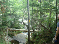
 As expected, we turned off onto Huntington just below the tree line and the crowds disappeared. I tripped and landed on a moss covered log. Lou didn't think anything of it, and neither would I, normally. But I had put pressure on my wrist, and it hurt. A lot. We saw only a couple people before we reached the treeline. Once the trees were gone people were easier to spot. The climb by the fan was tough and I was looking forward to reaching the headwall. Chatting with others, a woman looked at me surprised and said "this isn't the head wall?" "Um, no" I said.

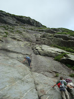 The headwall is one hell of a sight. Last time it scared the bejesus out of me and was where we had to turn around. I felt good but wondered about my wrist. And my sneakers. Well, at least my charlie horse wasn't bothering me much. The woman I spoke with and her friend were ahead of us. They spent some time looking and feeling and thinking and I was happy for the brief breather. In the end they chose to turn around.
 I put my hands on the rock face. I felt strangely confidant. Maybe because I had been there before or maybe because my legs, thanks to the squats, were in much better shape. At any rate, we went up. And it was fun.

 Above the headwall is a moonscape. Very little vegetation grows this high. We followed the cairns along a hard to see rock path. Relentless, just as I expected. Lou hadn't anticipated how relentless and grew tired of the monotony. We got close to the auto road and he wanted to follow it. I didn't. I hate road walking and was up for the challenge, but we followed it. He was exhausted and the road allowed us to double our pace. Soon the summit building came into view.

 Point to point, it was five and a half hours to the top. We stayed there for an hour and a half resting and gorging ourselves. The food item we both declared the most wonderful, most spectacular to partake in: Coca-Cola. I can't explain it. It was glorious.
I didn't want to bus down again so I let Lou get as much rest as we could afford and we took the easiest path down. Of course there is no easy path down, but we got back to Pinkham Notch well before sunset. Back at camp we built a fire and made food, even though we weren't very hungry. In the morning we stopped at Pinkham Notch and had the coldest showers of our lives.
 Lou did great. Much better than I in my first two attempts. It seems my wrist wasn't a problem. I can pull weight with it without problem, I just can't flex it backwards. And I really owe Mike at the YMCA a debt of gratitude for putting me on the leg squats routine. It made all the difference.
I want to go again.
Take a look at this guy's video. We met him on the hill that day.
Every year I try to do a "big hike". One that requires me to actually train. I'm in fair shape for a 43 year old computer jockey, but the rock pile requires a bit more.
My buddy Lou and I hiked Moosilauke last summer and he wanted to try the hardest trail on the toughest mountain in New England. That would be Huntington Ravine on Mount Washington. I had been up Huntington before so I knew what to expect. Lou hadn't and I did my best to warn him.
A little history: Back in 2003 my brother-in-law Mikey and I hiked Monadnock. It was tough but we wanted to try something bigger. Using the same thought process as Lou, I suppose, we tried Washington via Tuckerman. I wasn't prepared. I wrote about it and maybe I'll post what I wrote for history's sake.
We skipped 2004 then tried Huntington in 2005 with Mikey and another brother-in-law. We learned that he had a crippling fear of heights and we had to come back down. In 2006 Mikey and I did Katahdin. Twelve hours on the trail, 7 am to 7 pm. It was that hike that convinced me to always carry a flashlight. In 2007 Mikey, a co-worker Chuck, and I climbed Washington via Huntington. We took the bus down. 2008 was Franconia Ridge, Little Haystack to Lincoln to Lafayette. Mikey and my oldest son went on that one. That brings us to 2009 and Moosilauke, which you can read about if you are so inclined. The sneakers that nearly cost me my life that day were since trashed and I had considered getting serious hikers for Washington. I didn't end up doing that.
I did some treadmill, but as I've pointed out before, an hour on a treadmill ain't five minutes on the hill. So I also did weights. Squats, specifically. Lots of them. I lost maybe ten pounds, which was less than I wanted to. I was as prepared as I was going to get.
It was just Lou and I this trip. Mikey couldn't get off from work. We camped at Dolly Copp and made the trail around 9:30. Much later than I wanted to. I woke with a charlie horse. I get them maybe twice a year, and today was that day. Another injury also had me concerned. Back in May I was at a child's birthday party at a roller skating place. The last time I put on skates was 25 years earlier, maybe to the day, who knows. I was my post-prom at the very same rink. This day, on my last lap, I fell backwards and sprained my right wrist. At post time it still hurts. How would it react to climbing at the headwall?

 Pinkham Notch was busy. Very busy. First of all, it was the high season for through hikers, but added to that was the fact that there were two benefits going on. Alzheimer's and something else, I forgot. A lot of non-hikers were on the trail and I was glad to occasionally chat with them.
 As expected, we turned off onto Huntington just below the tree line and the crowds disappeared. I tripped and landed on a moss covered log. Lou didn't think anything of it, and neither would I, normally. But I had put pressure on my wrist, and it hurt. A lot. We saw only a couple people before we reached the treeline. Once the trees were gone people were easier to spot. The climb by the fan was tough and I was looking forward to reaching the headwall. Chatting with others, a woman looked at me surprised and said "this isn't the head wall?" "Um, no" I said.
 The headwall is one hell of a sight. Last time it scared the bejesus out of me and was where we had to turn around. I felt good but wondered about my wrist. And my sneakers. Well, at least my charlie horse wasn't bothering me much. The woman I spoke with and her friend were ahead of us. They spent some time looking and feeling and thinking and I was happy for the brief breather. In the end they chose to turn around.
 I put my hands on the rock face. I felt strangely confidant. Maybe because I had been there before or maybe because my legs, thanks to the squats, were in much better shape. At any rate, we went up. And it was fun.
 Above the headwall is a moonscape. Very little vegetation grows this high. We followed the cairns along a hard to see rock path. Relentless, just as I expected. Lou hadn't anticipated how relentless and grew tired of the monotony. We got close to the auto road and he wanted to follow it. I didn't. I hate road walking and was up for the challenge, but we followed it. He was exhausted and the road allowed us to double our pace. Soon the summit building came into view.
 Point to point, it was five and a half hours to the top. We stayed there for an hour and a half resting and gorging ourselves. The food item we both declared the most wonderful, most spectacular to partake in: Coca-Cola. I can't explain it. It was glorious.
I didn't want to bus down again so I let Lou get as much rest as we could afford and we took the easiest path down. Of course there is no easy path down, but we got back to Pinkham Notch well before sunset. Back at camp we built a fire and made food, even though we weren't very hungry. In the morning we stopped at Pinkham Notch and had the coldest showers of our lives.
 Lou did great. Much better than I in my first two attempts. It seems my wrist wasn't a problem. I can pull weight with it without problem, I just can't flex it backwards. And I really owe Mike at the YMCA a debt of gratitude for putting me on the leg squats routine. It made all the difference.
I want to go again.
Take a look at this guy's video. We met him on the hill that day.
Monday, August 2, 2010
John B. Hudson Trail, Arcadia
July 24, 2010
Only a couple photos this time. I didn't ask for permission again. Seven cub scouts and two boy scouts joined five parents for a walk on the John B. Hudson trail in Arcadia. It's only three miles and the weather was fine. A little hot, but cooler in the damp forest.
The trail is well marked and an easy stroll for little ones and urbanite moms alike. It passes by a historical graveyard (town of Exeter 101) where the boys took a brief break. The trail loops near the end and passes by Breakheart Pond.

We dallied by the pond. The boys appeared to be having a great time. The path back towards the graveyard was muddy much to the delight of the boys. A couple of the moms weren't quite as pleased. It dried up soon enough and we were back on the same trail that took us out. If you read my blog, you know how important I feel it is to get kids into the outdoors. A simple thing like a 45 minute drive, a 1 1/2 hour walk, and a light snack can do wonders. And we got a few scout requirements out of the way.
Only a couple photos this time. I didn't ask for permission again. Seven cub scouts and two boy scouts joined five parents for a walk on the John B. Hudson trail in Arcadia. It's only three miles and the weather was fine. A little hot, but cooler in the damp forest.
The trail is well marked and an easy stroll for little ones and urbanite moms alike. It passes by a historical graveyard (town of Exeter 101) where the boys took a brief break. The trail loops near the end and passes by Breakheart Pond.

We dallied by the pond. The boys appeared to be having a great time. The path back towards the graveyard was muddy much to the delight of the boys. A couple of the moms weren't quite as pleased. It dried up soon enough and we were back on the same trail that took us out.
If you read my blog, you know how important I feel it is to get kids into the outdoors. A simple thing like a 45 minute drive, a 1 1/2 hour walk, and a light snack can do wonders. And we got a few scout requirements out of the way.
Friday, July 23, 2010
Pachaug State Forest, Voluntown, Connecticut
July 9, 2010
With two hikes in my immediate future, one my Big one, I had better catch up with my walks.
I volunteer with my son's boy scout troop at summer camp each year. My now ex-coworker Lou and I got together on Friday to do a hike near both of us. He works over the line in Connecticut, and we had talked about doing some backpacking, so we chose Pachaug State Forest, which has a couple lean-to's we might wish to stay at in the future. This hike provided us a look-see. Yet again, no photos.
We met at the corner of routes 138 and 201, parked, and entered the woods. Normally I would follow along using my map, but my awesome Great Swamp Press map appears to be missing. Maybe it ended up with my scout gear, maybe Lou ended up with it. I'd hate to lose it. They are rather pricey.
We followed Pachaug Trail (I think half the trails in the forest are called Pachaug) until we got to the lean-to. Needed a sweeping, but in rather good shape. The area around it looked well used by hippy hiker and destructive teen alike. Next we doubled-back to take a look at mount Misery. At an astounding 441 feet above sea level, Misery provided for a significant climb. We got to the top and met up with a young family enjoying the view.
The bugs were fierce. I don't normally wear bug spray, but this day was the exception. We would wave our hands above our heads and knock away several deer flies that would return about a minute later. I've never been bitten by a deer fly but I understand they can be almost as painful as horse flies. Camp Yawgoog has lots of horse flies. My floppy brim hat kept them and the sun at bay.
We continued North because Lou wanted to see a location he had been to in his youth. The name escapes me. We got about half way there when Lou's curfew grew short. We doubled back to the start. I tried to entice him in getting a beer together, but his wife and child needed him home. We parted ways and I found a nice place that served cold beer and a better than average pub burger, by young ladies in tight t-shirts. I got back to camp to find out I missed meatloaf night.
With two hikes in my immediate future, one my Big one, I had better catch up with my walks.
I volunteer with my son's boy scout troop at summer camp each year. My now ex-coworker Lou and I got together on Friday to do a hike near both of us. He works over the line in Connecticut, and we had talked about doing some backpacking, so we chose Pachaug State Forest, which has a couple lean-to's we might wish to stay at in the future. This hike provided us a look-see. Yet again, no photos.
We met at the corner of routes 138 and 201, parked, and entered the woods. Normally I would follow along using my map, but my awesome Great Swamp Press map appears to be missing. Maybe it ended up with my scout gear, maybe Lou ended up with it. I'd hate to lose it. They are rather pricey.
We followed Pachaug Trail (I think half the trails in the forest are called Pachaug) until we got to the lean-to. Needed a sweeping, but in rather good shape. The area around it looked well used by hippy hiker and destructive teen alike. Next we doubled-back to take a look at mount Misery. At an astounding 441 feet above sea level, Misery provided for a significant climb. We got to the top and met up with a young family enjoying the view.
The bugs were fierce. I don't normally wear bug spray, but this day was the exception. We would wave our hands above our heads and knock away several deer flies that would return about a minute later. I've never been bitten by a deer fly but I understand they can be almost as painful as horse flies. Camp Yawgoog has lots of horse flies. My floppy brim hat kept them and the sun at bay.
We continued North because Lou wanted to see a location he had been to in his youth. The name escapes me. We got about half way there when Lou's curfew grew short. We doubled back to the start. I tried to entice him in getting a beer together, but his wife and child needed him home. We parted ways and I found a nice place that served cold beer and a better than average pub burger, by young ladies in tight t-shirts. I got back to camp to find out I missed meatloaf night.
Saturday, July 17, 2010
Ben Utter Trail, Arcadia
Some work day back in June.
My wife and boys arrived at my work with the idea of doing a hike. For once, it wasn't my idea. Her favorite was one of her first. The Ben Utter trail in Arcadia. I navigated a path from Narragansett to route 165. I dropped my car off in the church parking lot and transferred to her van. We took unpaved Frosty Hallow trail to Plain Road.
I learned when I did the Shelter trail a few weeks earlier that Plain road was barred a fair ways from our trail head. I also learned that Plain road was in unusually bad shape. My wife is not in the habit of slowing down on bad roads. We stopped where Plain road did and was preparing to walk the rest of the way, when a lady in an SUV drove around the barrier. We decided to follow. Plain road got worse and had to slow a little. We found the trail head parked next to the SUV.
The camera stayed home so no pictures yet again. We followed the trail as usual and I took the opportunity to do some scout requirements for my ten year old. We hiked to stepping stone falls, had a snack, then went by the abandoned shelter on our way back. It felt good to be in the woods.
W made it back in reasonable time and drove home. The transmission work only cost me $100, so I count myself as lucky.
My wife and boys arrived at my work with the idea of doing a hike. For once, it wasn't my idea. Her favorite was one of her first. The Ben Utter trail in Arcadia. I navigated a path from Narragansett to route 165. I dropped my car off in the church parking lot and transferred to her van. We took unpaved Frosty Hallow trail to Plain Road.
I learned when I did the Shelter trail a few weeks earlier that Plain road was barred a fair ways from our trail head. I also learned that Plain road was in unusually bad shape. My wife is not in the habit of slowing down on bad roads. We stopped where Plain road did and was preparing to walk the rest of the way, when a lady in an SUV drove around the barrier. We decided to follow. Plain road got worse and had to slow a little. We found the trail head parked next to the SUV.
The camera stayed home so no pictures yet again. We followed the trail as usual and I took the opportunity to do some scout requirements for my ten year old. We hiked to stepping stone falls, had a snack, then went by the abandoned shelter on our way back. It felt good to be in the woods.
W made it back in reasonable time and drove home. The transmission work only cost me $100, so I count myself as lucky.
Saturday, June 26, 2010
North South Trail, Kenyon Hill to Roaring Brook Pond
Saturday, May 22nd
Maybe my interest in blogging is waning. All blogs have a life expectancy. Maybe I am seeing the end. My interest in hiking, however, has not. With my son's Boy Scout troop, we hiked 8.7 miles.
First, there are no pictures. I didn't take many, but none are included because when I asked if anybody objected to having photos posted on the internet, a couple scouts said yes. I don't know if they were serious, but then again, I didn't ask. We picked up where we left off, on Kenyon Hill Road.
Five scouts, the Scoutmaster, and I entered the forest and walked until it turned into a well groomed community. We followed streets until we reached route 138. We turned right towards the Richmond Elementary School. There was a farmers market going on, but it was across the street. The boys decided not to investigate. We turned left onto Nooseneck Hill Road, where we saw and smelled cows.
We turned left onto Buttonwoods Road. A little ways up we turned North into the woods again. Soon we stopped for lunch. The trail connects with the "New London Turnpike", which an ATV would be hard pressed to traverse in comfort. Along the way we crossed a makeshift living room, complete with couch, rug, and lamp. We joked that this is were we should have lunched, but clearly few would want to touch the junk.
A little bit more road work, then we were back into the woods. We crossed under route 95. We followed the trail until it turned onto Tuft Hill Trail, a dirt road off of which I parked. The boys and Scoutmaster chose to walk the boardwalk around Roaring Brook Pond to the paved road. I brought the van around.
There was a lot of street walking, but it was fine. Much of it was very pretty. The weather cooperated and we managed to get through the tenderfoot material for our youngest scout.
Maybe my interest in blogging is waning. All blogs have a life expectancy. Maybe I am seeing the end. My interest in hiking, however, has not. With my son's Boy Scout troop, we hiked 8.7 miles.
First, there are no pictures. I didn't take many, but none are included because when I asked if anybody objected to having photos posted on the internet, a couple scouts said yes. I don't know if they were serious, but then again, I didn't ask. We picked up where we left off, on Kenyon Hill Road.
Five scouts, the Scoutmaster, and I entered the forest and walked until it turned into a well groomed community. We followed streets until we reached route 138. We turned right towards the Richmond Elementary School. There was a farmers market going on, but it was across the street. The boys decided not to investigate. We turned left onto Nooseneck Hill Road, where we saw and smelled cows.
We turned left onto Buttonwoods Road. A little ways up we turned North into the woods again. Soon we stopped for lunch. The trail connects with the "New London Turnpike", which an ATV would be hard pressed to traverse in comfort. Along the way we crossed a makeshift living room, complete with couch, rug, and lamp. We joked that this is were we should have lunched, but clearly few would want to touch the junk.
A little bit more road work, then we were back into the woods. We crossed under route 95. We followed the trail until it turned onto Tuft Hill Trail, a dirt road off of which I parked. The boys and Scoutmaster chose to walk the boardwalk around Roaring Brook Pond to the paved road. I brought the van around.
There was a lot of street walking, but it was fine. Much of it was very pretty. The weather cooperated and we managed to get through the tenderfoot material for our youngest scout.
Thursday, May 27, 2010
Shelter Trail, Arcadia
Saturday, May 15
A little late getting around to posting, huh?
I was supposed to assist with DEM and AMC volunteers for a maintenance project on the Ben Utter trail in Arcadia. I got a late start. A very late start. I figured I would just find them on the trail. I was wrong.
The forest path that is called Austin Farm Road is now blocked before you reach the Ben Utter trail head. Had I remembered my Arcadia map from Great Swamp Press, I might have figured that out. I didn't have any cell phone numbers, so after an hour of pointless driving around, I stopped at the Shelter trail and started walking.
After a short walk, maybe a half mile, I ended at a river (Flat River, I learned). I saw a side path a short walk back, so I took it. Come to find out, the walk to the river is the side trail and I was back on Shelter trail proper. I followed until it reached some, well, shelters. Mostly dissolved at this point. I continued on.
I passed Penny Cut off but stayed on Shelter. I came to a spot that was quite beautiful. I took some pictures. Continuing on, I apparently merged onto Breakheart trail. I heard people ahead and wondered if it was the camp. Camp E-Hun-Tee is for kids in bad situations, I understand. I know very little about it, except that it's off limits. Soon, I came upon some boys near some makeshift shelters. From a distance I asked if this was the camp. One said it was. I said I should turn around, then. They agreed. I didn't think I was close to the camp at all and wondered why there were no signs warning me. Soon I passed a tree with a sign about twenty feet up it. Knowing where I was and knowing the situation, I figured out that it was a warning that the camp was off limits. Otherwise, I would have had no idea. They need a new sign, and they need to hang it lower.
I followed the trail back, stopping off at a concrete foundation to take care of some feet problems. My old hikers were tearing my feet up fairly bad. I popped on a couple bandages and continued on. I got back to the car and headed home.
The volunteer group worked a different section of the trail, I learned. They ask me to volunteer about three times a year, and I've only managed to participate once.
A little late getting around to posting, huh?
I was supposed to assist with DEM and AMC volunteers for a maintenance project on the Ben Utter trail in Arcadia. I got a late start. A very late start. I figured I would just find them on the trail. I was wrong.
The forest path that is called Austin Farm Road is now blocked before you reach the Ben Utter trail head. Had I remembered my Arcadia map from Great Swamp Press, I might have figured that out. I didn't have any cell phone numbers, so after an hour of pointless driving around, I stopped at the Shelter trail and started walking.
After a short walk, maybe a half mile, I ended at a river (Flat River, I learned). I saw a side path a short walk back, so I took it. Come to find out, the walk to the river is the side trail and I was back on Shelter trail proper. I followed until it reached some, well, shelters. Mostly dissolved at this point. I continued on.
I passed Penny Cut off but stayed on Shelter. I came to a spot that was quite beautiful. I took some pictures. Continuing on, I apparently merged onto Breakheart trail. I heard people ahead and wondered if it was the camp. Camp E-Hun-Tee is for kids in bad situations, I understand. I know very little about it, except that it's off limits. Soon, I came upon some boys near some makeshift shelters. From a distance I asked if this was the camp. One said it was. I said I should turn around, then. They agreed. I didn't think I was close to the camp at all and wondered why there were no signs warning me. Soon I passed a tree with a sign about twenty feet up it. Knowing where I was and knowing the situation, I figured out that it was a warning that the camp was off limits. Otherwise, I would have had no idea. They need a new sign, and they need to hang it lower.
I followed the trail back, stopping off at a concrete foundation to take care of some feet problems. My old hikers were tearing my feet up fairly bad. I popped on a couple bandages and continued on. I got back to the car and headed home.
The volunteer group worked a different section of the trail, I learned. They ask me to volunteer about three times a year, and I've only managed to participate once.
Subscribe to:
Posts (Atom)